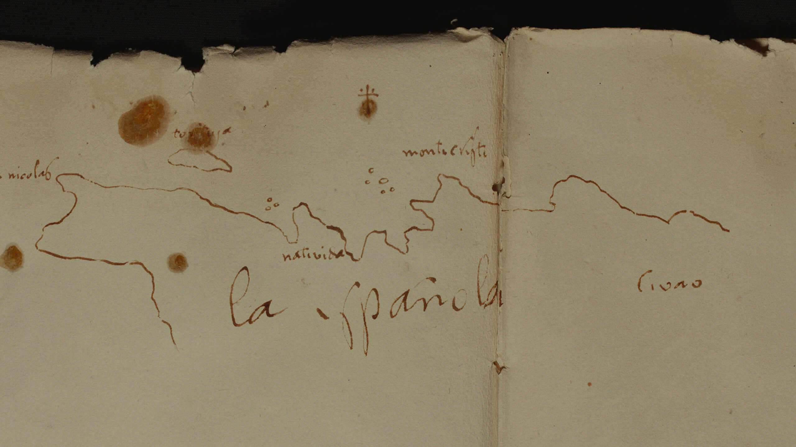
First map drawn by Columbus soon after his arrival in the Americas.
The upper part shows the Atlantic Ocean, while the lower part depicts the coast of the island where he landed and from which he set sail toward Baneque—which, needless to say, was nowhere to be found.
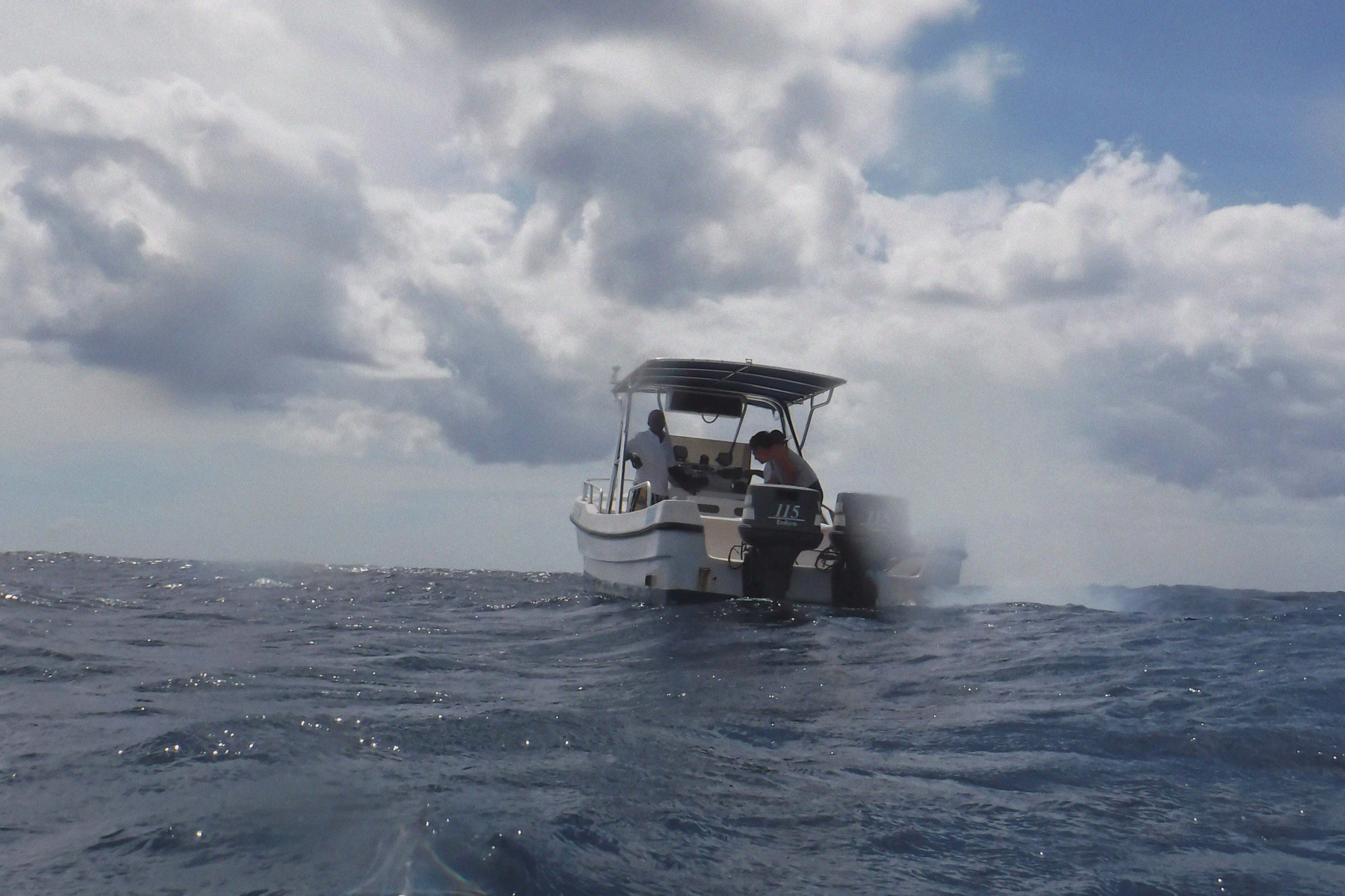
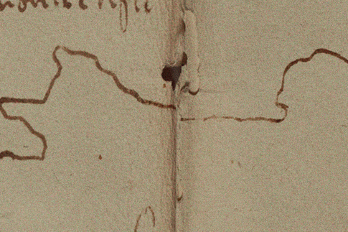
For this project, the artist was set to “discover” what had never been found by the colonial enterprise. Departing from the very map drawn by Columbus, Santillán traveled to its void.
The artist went there and gathered many liters of sea water.
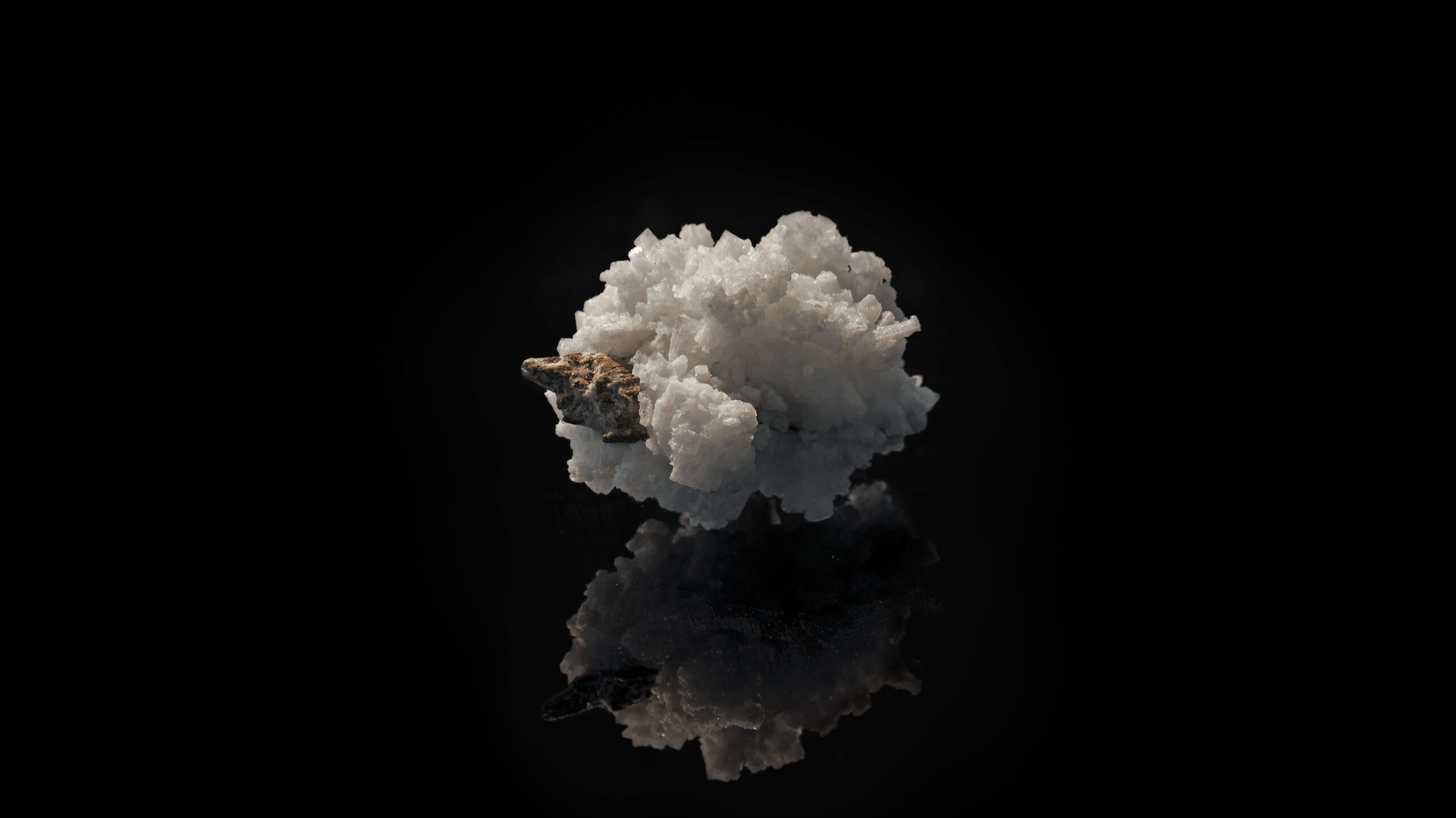
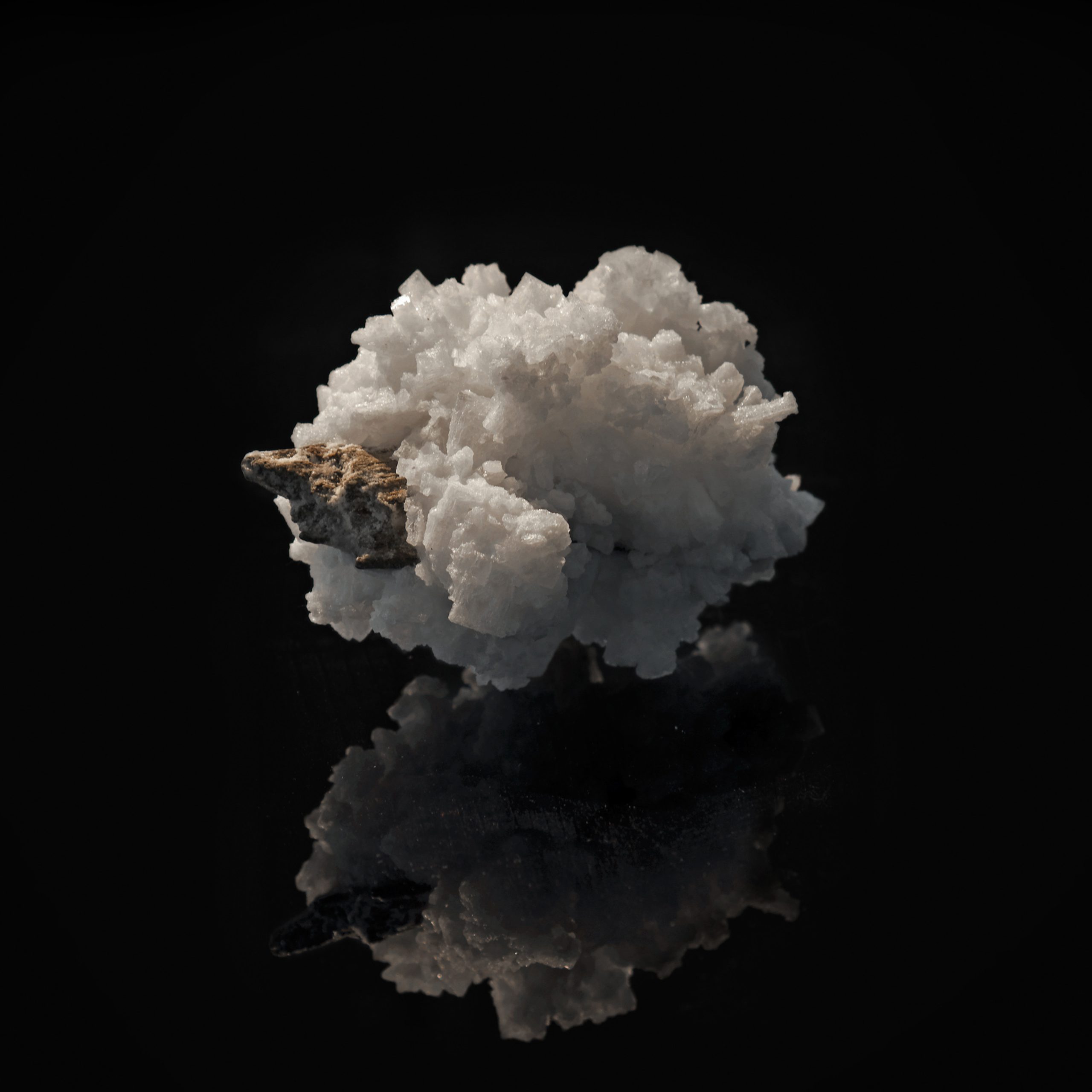
In the following days, the gathered sea water was left to naturally evaporate. From this process, crystals and minerals began appearing. At last, the phantom island revealed itself.
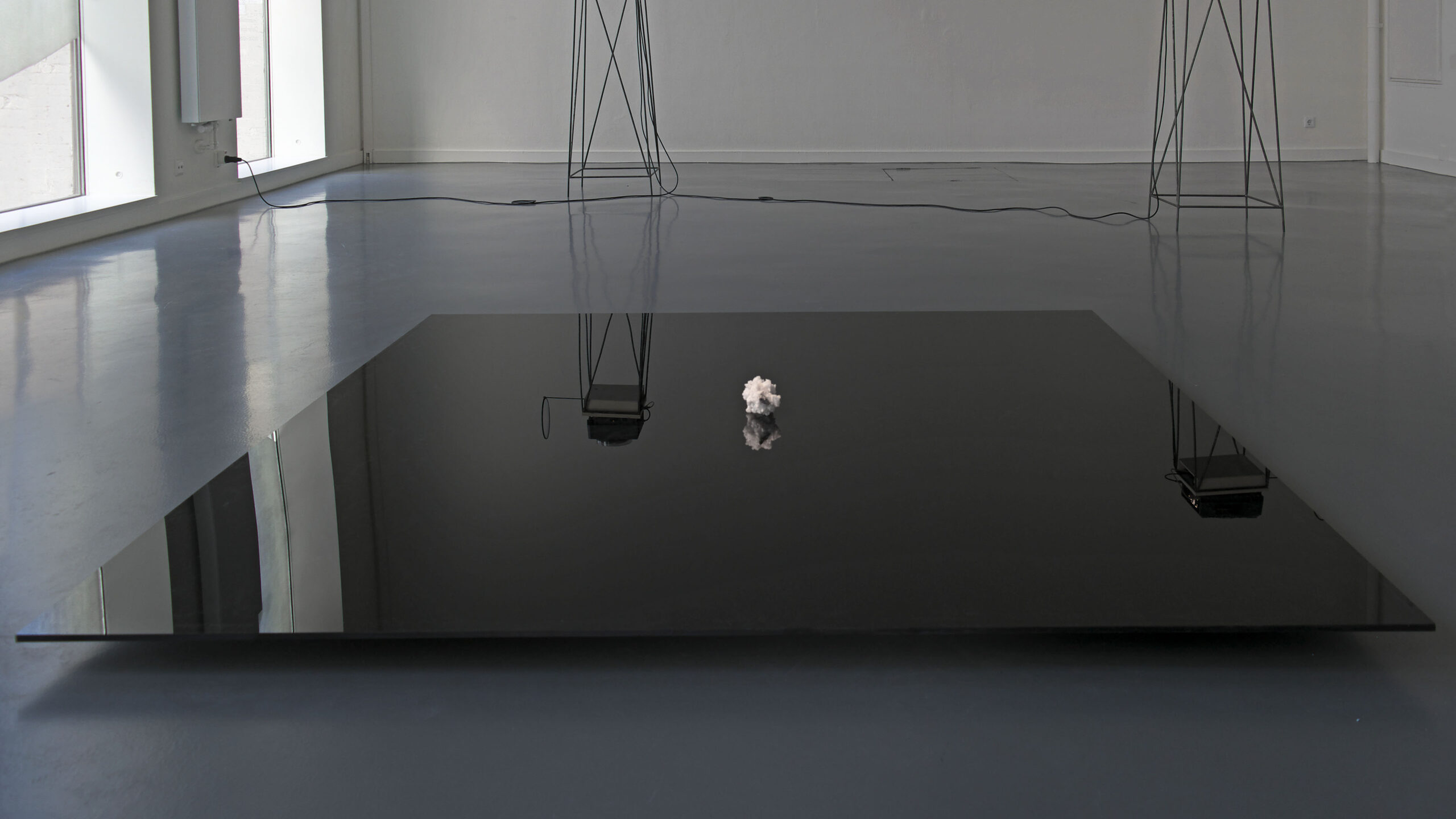
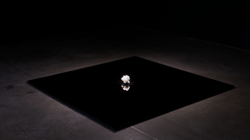
The crystallized island of Baneque is displayed on a large black plexiglass panel, here on view at Kunstinstituut Melly in Rotterdam.